Hiking to the Mouth of the Gila Box
We watched the Gila River flow at The Nature Conservancy's (TNC) Lichty Ecological Research Center, four miles south of where it emerges from the Mogollon Range (in the background), and the rugged Gila Wilderness. The TNC's Gila Riparian Preserve here protects more than 1,200 acres of fragile Southwest riparian habitat and verdant gallery woodland along the Gila River, the last of the Southwest's major free-flowing rivers.
The Gila is a rare example of a river with a natural pattern of flows that are unimpeded by dams. They range from winter floods to snowmelt run-off and low flows in spring. A variety of native plants and animals have adapted to these seasonal pulses of flooding and drought, including a number of endangered species.
Two-and-a-half miles upstream from the Lichty Center, we set out to hike to the mouth of the box canyon where the Gila River exits the mountainous Gila Wilderness: the world's first designated wilderness area and New Mexico's largest.
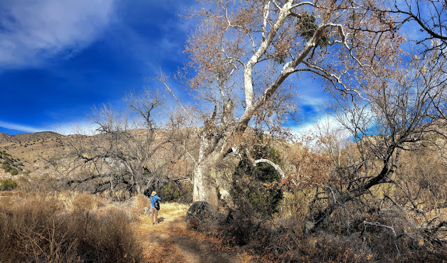
. . . including this Dr. Seuss-looking sycamore with mistletoe in it.
The Gila River flows through a pristine gallery of cottonwood, willow, sycamore and other trees.
This gallery of cottonwoods is the kind of ecosystem that is dying out along major rivers like the Rio Grande where levees have been built to control flooding and create drained and irrigated agricultural lands. This prevents a river from flooding its banks and moving its channel across its floodplain, disconnecting it from its river plain forest habitat, which is then starved of nutrients and the conditions needed for its renewal and sustenance.
Massive cottonwoods have grown up and died along this abandoned side channel. We startled, and were startled by, a javelina near here.
A venerable old cottonwood. We saw some sandhill cranes here.
Sycamore trees have ghostly, white bark.
The Gila River makes its first run on level ground here after emerging from the Mogollon Range in the background and heads south. Mount Watson, on the right in the background, was a favorite stronghold for the Apache leaders Geronimo and Mangas Coloradas.
The river makes a sharp bend to the right/east.
Looking at a sycamore tree in the floodplain.
This sycamore has developed multiple trunks that form a ring . . .
. . . enclosing an intriguing space . . .
. . . that creates a natural room, inviting one to come in . . .
. . . and appreciate . . .
. . . the beauty of this place . . .
. . . and the patterns on sycamore bark.
Another sycamore with an intriguing shape, hosting mistletoe, and surrounded by cottonwoods.
A portal to another room?
At the point where the Gila River exits the mountains that are its source, it makes a sharp bend around the toe of a ridge where a water gauge has been added to measure flow.
We clambered up the side of the box canyon to get an elevated view.
One the way up, I found this rock with veins of copper that matched the turquoise color of the pattern on my shirt.
Gaining elevation, we could see downstream, along the river channel, which goes diagonally from left-to-right along the line of evergreens and gray, leafless trees.
A little higher . . .
Approaching the top . . .
Here we could see the river emerging from the mountains on the left and making a wide, curving arc (at right), swinging south and then east (back toward the left).
A beautiful piece of "the Gila" country!
1/1/2021 with Rich Schrader


Comments
Post a Comment